The J.D. Shatford Memorial
Trust

| Home |
| About the Trust |
| Scholarship Grants |
| Project Grants |
| Trust Area |
| Contact |
| Acknowledgements |
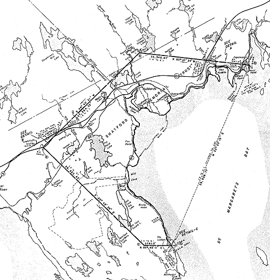
Below is a copy of the Trust Survey Map that reflects the actual geographic boundaries of the J.D. Shatford Memorial Trust.
To download a high resolution (300 dpi) PDF version of the map please click here or on the map below. (This is a large image and how quickly it downloads will depend on the speed of your Internet access.)
To
download Adobe Acrobat PDF reader click here![]()
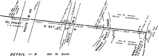
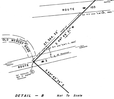
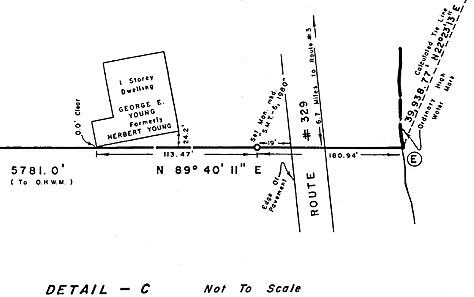
To access high resolution PDFs of three map details that correspond to important intersections of boundary lines in populated areas click here (Detail A, Detail B, Detail C) or on the images beneath the main map below.
For reference the addresses below mark the current geographic boundaries of the Trust: